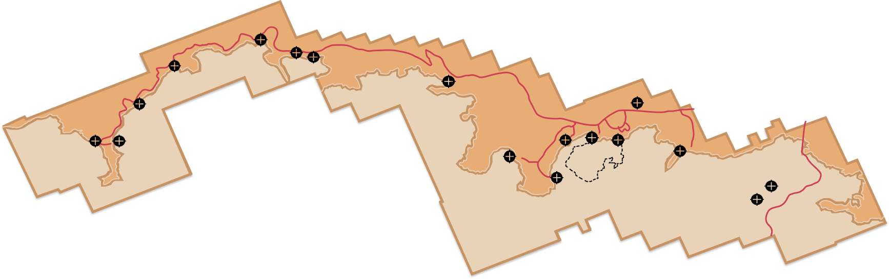
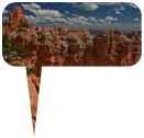
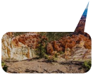
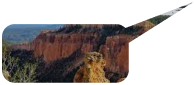
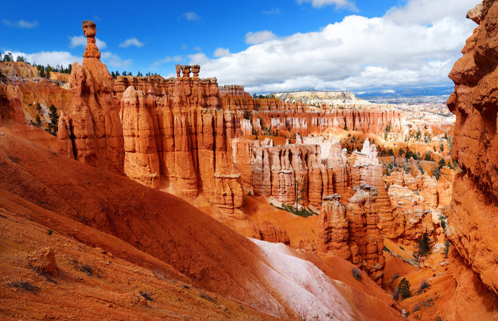
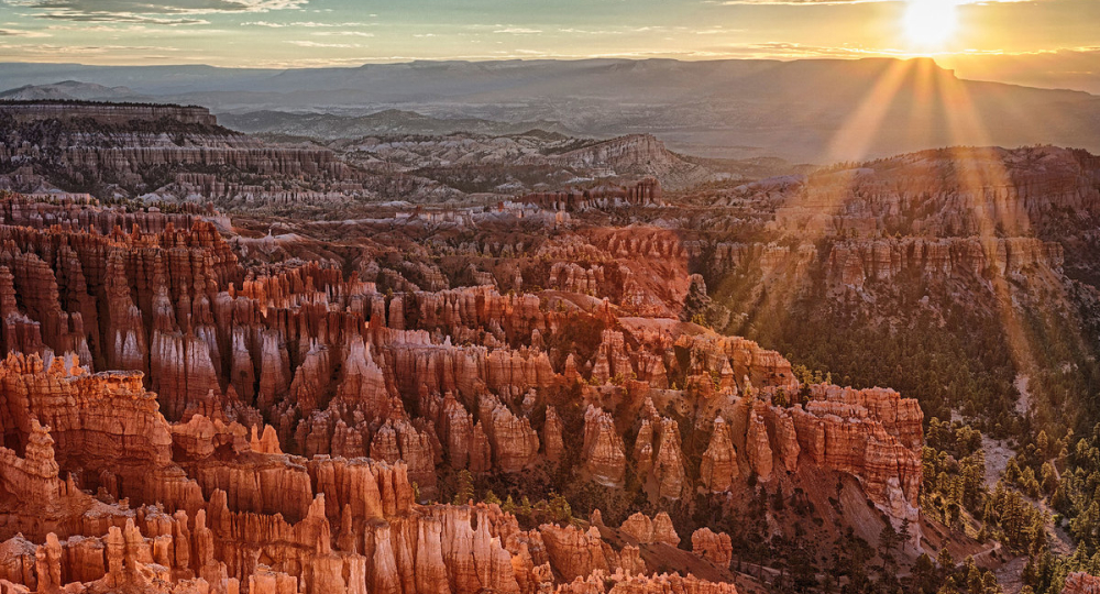
Hoodoos (irregular columns of rock) exist on every continent, but here is the largest concentration found anywhere on Earth. Situated along a high plateau at the top of the Grand Staircase, the park's high elevations include numerous life communities, fantastic dark skies, and geological wonders that defy description.
Choose a location on the map to tour Bryce Canyon National Park.
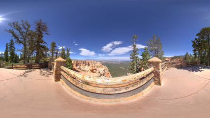
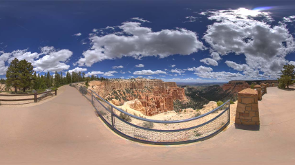
We encourage our visitors to start their auto tour of Bryce Canyon National Park by driving directly to the very southern end first. From here at Rainbow Point the entirety of the park stretches out before you back to the north.Before you leave the Rainbow Point area make sure you walk to the southern overlook — Yovimpa Point. Here is one of the places you can get a good look at the sequence of rock layers called the Grand Staircase.
More Info
Rainbow & Yovimpa viewpoint
Summer
5
Along with Rainbow Point, Yovimpa Point is one of the highest viewpoints in the park. Tectonic uplift has lifted this entire scene from sea-level over the course of the last 20 million years to later be dissected by tributaries of the Colorado River. Tilting that occurred during uplift has situated the southern end of the park approximately 1,000 ft (304 m) higher than its northern end. Here you can gaze from the southern tip of the Paunsaugunt plateau and overlook the colorful cliffs of the Grand Staircase.
More Info
Yovimpa Viewpoint
Summer
3
The park has its share of misnomers (Mossy Cave isn't a cave, the canyon isn't really a canyon...) and Black Birch Canyon would be another. Since black birch (Betula lenta) only occurs in the east, it's likely quaking aspen (Populus tremuloides) were mistaken for these. Birch are famous for having bark that peels back like paper; aspen bark does not peel. Whereas aspen leaves are perfectly flat, birch leaves are slightly "V" shaped and more elongated than Quaking Aspen leaves. More Info
Black Birch Canyon
Summer
3
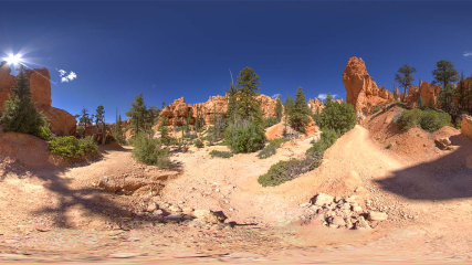
Just as geology determines biology, biology also impacts the geology. From this vantage point you can see how the type of rock that composes the different steps of the Grand Staircase determines what kinds of plants can grow on it. The varying densities of vegetation determine how erosion shapes the land.In the slick rock sandstone of the White Cliffs the soil is thin or nonexistent and plants cannot easily take hold.
More info
Ponderosa Canyon
Summer
2
Though the name tends to be misleading, Natural Bridge is one of several natural arches in Bryce Canyon and creates a beautiful scene at this viewpoint. This arch, sculpted from some of the reddest rock of the Claron Formation (rich in iron oxide minerals), poses a stark contrast to the dark green of the Ponderosa forest that peeks through the arch from the canyon below.
More info
Natural Bridge
Summer
2
Piracy Point has been said to take its name from the buttes that might resemble pirate ships sailing alongside the rim, but it's more likely that the name refers to a geomorphological process that is soon to take place here. This point overlooks Swamp Canyon and the Sheep Creek drainage system to the north and the Willis Creek drainage system that collects run-off south from here. The broad, sloping valley to the north of you currently drains to Sheep Creek, but on the other side of the cliffs right of it, tributaries of Willis Creek are steadily encroaching.
More Info
Piracy Point
Summer
3
Farview Point is appropriately named, with spectacular views of famous landmarks that make up the Grand Staircase. From north to south you can see: the Aquarius Plateau (Pink Cliffs), the Kaiparowits Plateau (Grey Cliffs), Molly's Nipple (White Cliffs), and even glimpses of the Kaibab Plateau on which lies the North Rim of the Grand Canyon. These magnificent views result from Bryce Canyon's extremely high air quality, with potential visibility as far away as the Black Mesas in Arizona — up to 160 miles! Navajo Mountain, 90 miles away on the border of Utah and Arizona, can be seen on all but the worst days.
More Info
Fairview Point
Summer
2
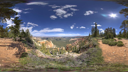
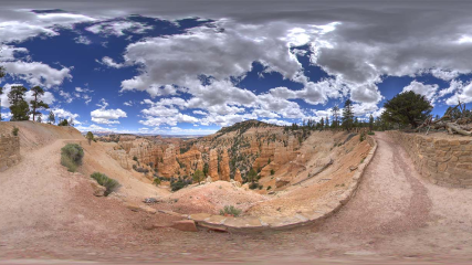
Swamp Canyon appears relatively small and sheltered from the overlook, bounded on both sides by fins and hoodoos. This size allows the viewer to develop a more intimate connection with the landscape than some of the grander viewpoints may provide.
More Info
Swamp Canyon
Summer
1
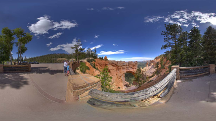
From Bryce Point, one of the most scenic vistas of the full amphitheater and all its wonders amaze the visitor. Bryce Point is famous for its extraordinary sunrises. From here you can watch the tops of hoodoos set alight as if by fire from the first rays of the rising sun. Like fire, the orange light quickly spreads driving shadows from all but the deepest recesses of the amphitheater.
More Info
Bryce Point
Winter
3
Photographers seeking sunset pictures are often disappointed by the fact that most of the cliffs and hoodoos of Bryce Canyon do not face the setting sun. Paria View is one exception. Here one prominent and photogenic castle-like hoodoo rises high above the canyon floor to absorb the last rays of the setting sun. Paria is a Paiute word meaning "water with elk" or "water with mud". The translation varies depending on context and season.
More Info
Paria View
Summer
2
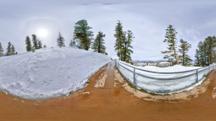
Another great way to explore Bryce Canyon is on cross-country skis. Though it is illegal to ski off of the rim into the canyon, you can enjoy a variety of routes above the rim. These include sections of the Rim Trail along the edge of the Main Amphitheater, the Bristlecone Loop Trail; Paria Ski Loop; and the unplowed Paria View and Fairyland Point roads. More Info.
More Info
Paria View
Winter
3
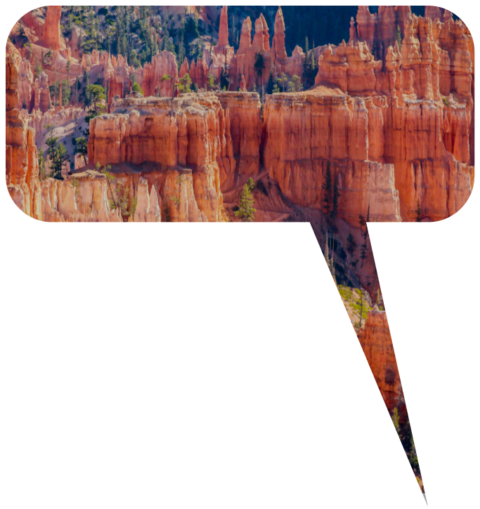
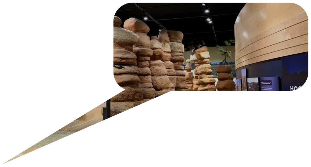
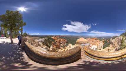
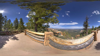
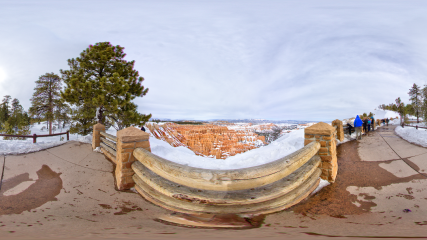
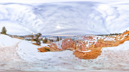
Along with Bryce Point, Inspiration Point provides a birds-eye view of the world's largest collection of rock spires called "hoodoos" found within the Bryce Amphitheater. The viewpoint here consists of three levels that provide varied spectacular perspectives in all directions. The Claron Formation consists of two members, the lower Pink Member, a "dirty" limestone that contains sand, silt, and iron that lends the rock its reddish color, and the upper White Member, a purer freshwater limestone. This upper White Member of the Claron Formation is visible below Inspiration Point, although few hoodoos form in this softer rock.
More Info
Inspiration Point
Winter
4
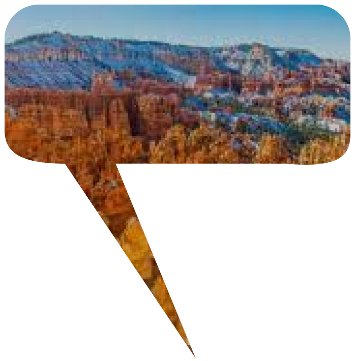
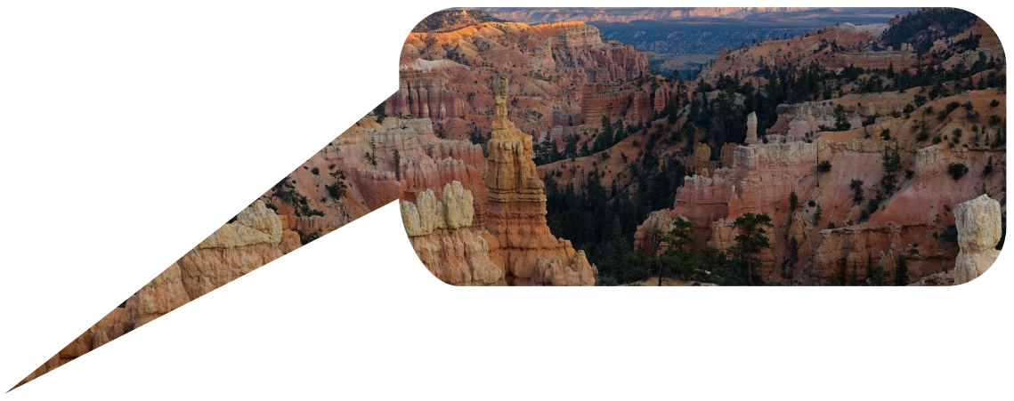
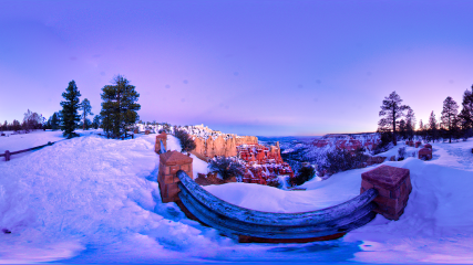
Sunset Point offers vistas of some of the most famous and breathtaking of Bryce Canyon's hoodoos. Directly below the point and to the south, the Silent City rises from the canyon floor, a maze of hoodoos and fins packed in tight formation. Just below the overlook on the northern edge, Thor's Hammer stands alone. Striking in form due to its isolation from other hoodoos, Thor's Hammer is a favorite among visitors.
More Info
Sunset Point
Winter
16
The iconic Navajo Loop Trail begins and ends at Sunset Point. Its switchbacks wind between narrow walls of colorful limestone with views of towering Douglas-fir trees and the park's most famous hoodoo: Thor's hammer. The loop has two sides: Two Bridges and Wall Street. The Two Bridges side is open year-round, however, the Wall Street side is closed during the winter months. During this time Two-Bridges can be hiked as an out-and-back trail or combined with other trails.
More Info
Sunrise Point - Sunset Point
Summer
19
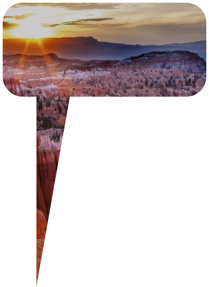
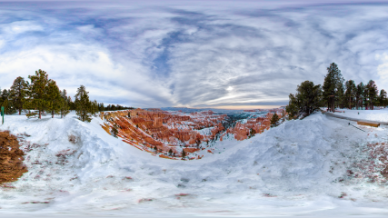
The view to the northeast from Sunrise Point captures Boat Mesa and the Sinking Ship, set against the stark Pink Cliffs of the Aquarius Plateau. Boat Mesa, capped by the resistant rock called "The Conglomerate at Boat Mesa," rises above the hoodoos of Fairyland Canyon to an elevation of 8073 feet.
More Info
Sunrise Point
Winter
29
The Fairyland Loop is a quiet 8 mile hike that combines hiking along the plateau rim near Boat Mesa with a hike in the canyon with long views of the Bryce Amphitheater surrounded by unique hoodoos. You can start this hike at Fairyland Point or on the rim trail north of Sunrise Point at the Tower Bridge trailhead. We recommend hiking in a counter-clockwise direction. There is no shuttle pick-up at Fairyland Point, so you will need to hike to your starting point.
More Info
Fairyland Point
Summer
2
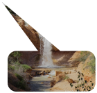
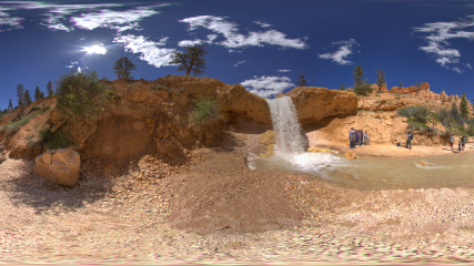
The presence of water alone is what makes Water Canyon unique. Although you might not see them (animals tend to avoid busy trails - especially in daylight hours), a wide diversity of animals come here regularly to quench their thirst. The supply of water is still recent enough that nature hasn't quite caught up yet. Eventually more riparian trees like willows and cottonwoods will probably grow here. In the meantime you'll be surprised to see some plants that you might expect to find along a brook in a mountain meadow, such as Mountain Death Camas and Watson Bog Orchid.
More Info
Mossy Cave Trail
Summer
1
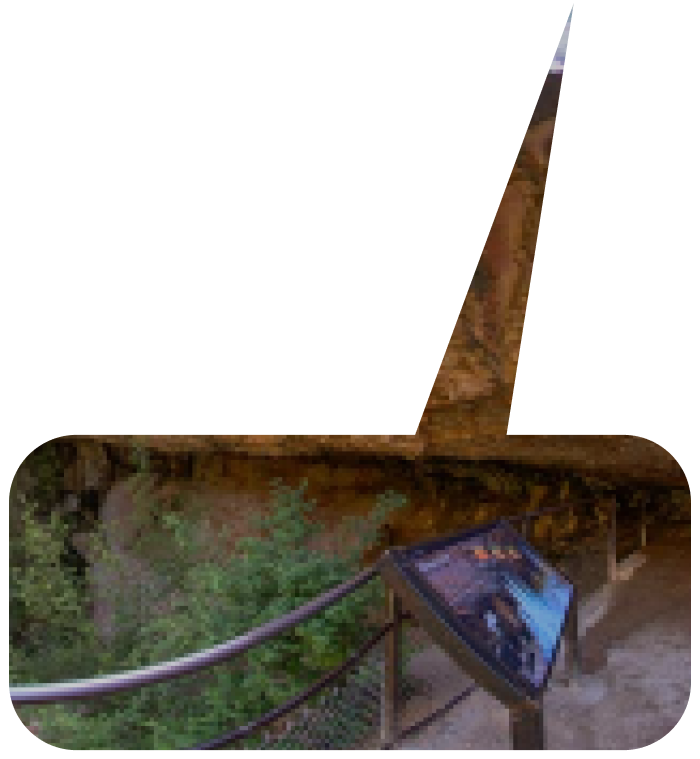
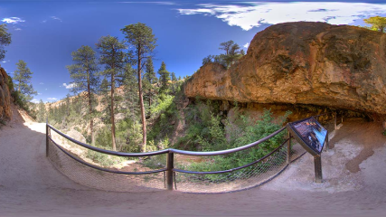
Mossy Cave trail is one of the lowest elevation hikes in the park as well as one of the only hikes that begins with a climb and ends with a descent. This trail provides access to Water Canyon in one direction and to a sheltered overhang known as Mossy Cave in the other. This area is filled with mosses in the summer and icicles in the winter.
More Info
Mossy Cave Trail
Summer
1
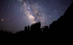
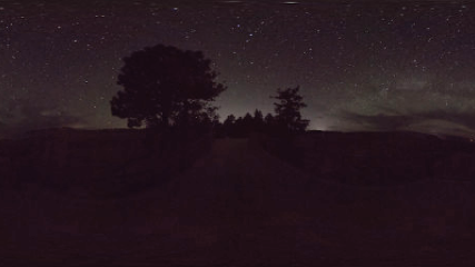
Bryce is a phenomenal place for stargazing, but before planets and stars appear, look quickly for the rare sight of Earth's penumbra. After the last light of the setting sun fades from the highest clouds, suddenly a purple band will appear directly above the eastern horizon. This is the edge of Earth's own shadow being projected on to the atmosphere. Look quickly because this phenomenon is soon engulfed in darkness as the stars take the stage.
More Info
Sunset Point
Night
1